| Projects | Publications |
Evaluating the effects of vehicle fleet, travel demand, and road network changes on traffic emissions and near-road air quality in a dense urban neighbourhood using a microscopic simulation
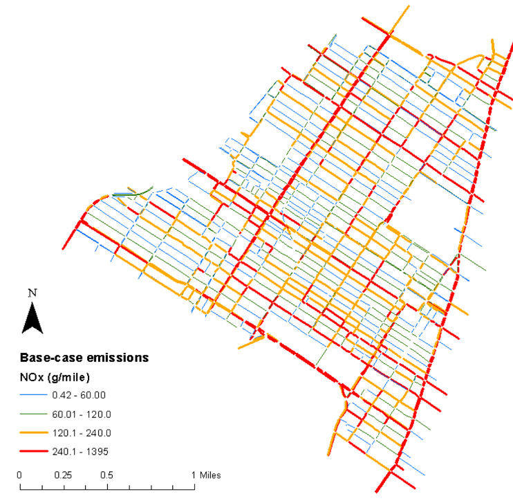
In this study we develop a traffic simulation for a dense neighbourhood in the City of Montreal (8,656 links) linked with a regional traffic assignment model used to determine the travel demand originating in- and destined to the study area. Using a version of the USEPA's Motor Vehicle Emissions Simulator (MOVES) fit with local data, we simulate traffic emissions for each link using instantaneous speed profiles. Emissions of greenhouse gases (GHG), nitrogen oxides (NOx), and carbon monoxide (CO) are modelled under a range of regional and local policies including fleet renewal, street closures, reduced demand, reduced internal car trips, and reduced 'through traffic'.
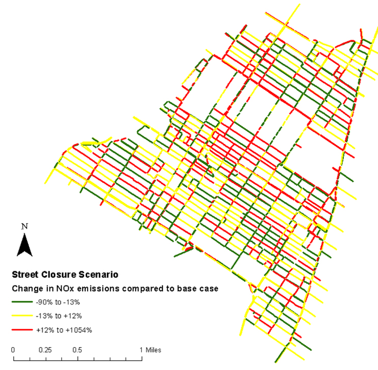
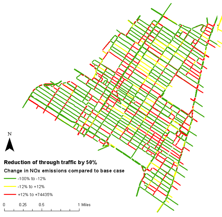
Due to the high congestion levels in the neighbourhood under base case conditions, we observe limited network-wide reductions of emissions except in the scenario aiming at reducing 'through traffic' (29% reduction in GHG compared to the base-case). We note significant changes in the spatial patterns of emissions.
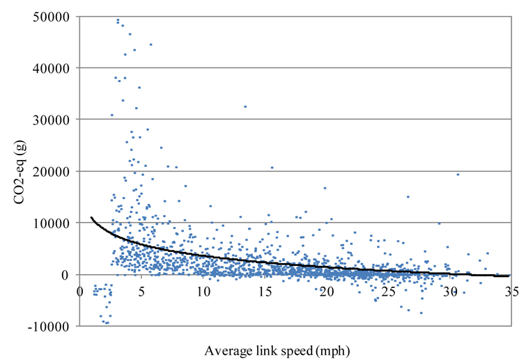
We also compare average and instantaneous speed-based estimates and observe that the average-speed mode tends to overestimate total emissions as network speeds decrease. Finally, dispersion modelling is conducted along selected corridors in order to evaluate the effects of different scenarios on air quality. We observe significant increases in air pollution as a result of the street closure scenario and significant decreases with the reduced 'through traffic' scenario.